Where Is Plovdiv Located In Bulgaria?
Where Plovdiv sits on the map of Bulgaria: the southern plain between the Rhodopes and the Balkan Range, its six hills, and how to reach it from Sofia and abroad.
Plovdiv is an inland city in southern Bulgaria, the country's second-largest, built around six hills on the Thracian plain where the Maritsa river crosses the upper lowlands between the Rhodope Mountains to the south and the Balkan Range to the north. It has no sea coast. The municipal tourism site dates the first settlement on Nebet Tepe, the oldest of the hills, to the 4th millennium BC, and the city is often described as one of the oldest continuously inhabited cities in Europe. Its location, on the plain rather than the coast, at the point where routes from the Aegean climb toward the interior of the Balkans, is the reason a settlement has existed here for so long.
Where Is Plovdiv Located In Bulgaria?
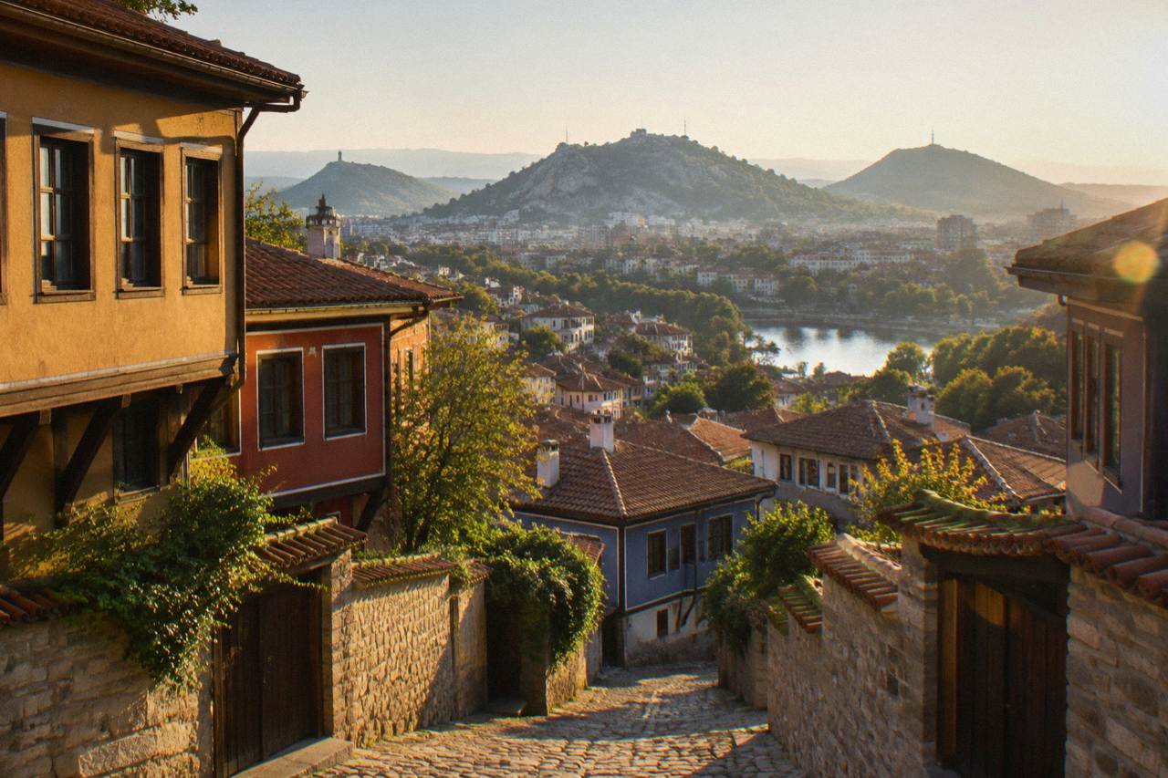
Plovdiv is located in southern Bulgaria, in the western part of the Upper Thracian Plain, on both banks of the Maritsa river and around six hills: Nebet Tepe, Dzhambaz Tepe, Taksim Tepe, Sahat Tepe, Bunardzhika and Dzhendem Tepe. The city stands a direct train ride of about 2 h 40 to 3 h 05 southeast of Sofia, about 30 kilometres north of the northern foothills of the Rhodope Mountains, and roughly 100 kilometres from the Greek border, reached via the roads that run south through Asenovgrad toward Smolyan and the mountains.
That single sentence answers the question, but each part of it carries a consequence for a trip. The six hills, which the municipal tourism site lists with their heights, are not decoration: they organise the whole city. Three of them, Nebet, Dzhambaz and Taksim Tepe, cluster together as the Three Hills, the core of the Old Town.
The location also explains the climate. The ERA5 reanalysis for Plovdiv, 1991-2020, puts the mean daily high at 28.2 C in July and 5.9 C in January, with May the wettest month of the year at 56.8 mm: a continental pattern of hot summers and cold winters, moderated only slightly by the plain. Snow does fall in winter, and the answers page on snow covers what that means in practice.
The plain position matters for access too. Plovdiv sits on the main Sofia to Plovdiv to Burgas rail corridor, which is why direct trains reach it from the capital in under three hours. The Plovdiv Travel Guide homepage covers the city's core sights; this page stays with the map.
Which Region Of Bulgaria Is Plovdiv In?
Plovdiv is in south-central Bulgaria, in the upper Thracian Lowland region that Bulgarians call the Upper Thracian Plain, within Plovdiv Province, of which the city is the administrative centre and the largest settlement. The plain runs west to east between the Balkan Range to the north and the Rhodope Mountains to the south. To the west lie Pazardzhik and the road toward Sofia; to the east, Stara Zagora and the valley of the roses toward Sliven and Burgas; due south, the Rhodopes rise toward Asenovgrad, Bachkovo and Smolyan.
Administratively the city is the capital of Plovdiv Province, one of Bulgaria's twenty-eight provinces, and it anchors the second-largest urban economy in the country. Culturally its position is a hinge: the same latitude band as the Thracian heartland that produced the royal tombs around Kazanlak, and the same river valley that the Thracians, Romans and Ottomans each used as a corridor. The city's historical names, from Philippopolis to Trimontium to Filibe, all belong to this one river-crossing location, as the municipal tourism site's history pages list them.
The regions around the city are the basis of its day-trip geography. Asenovgrad and Bachkovo Monastery sit in the first Rhodope foothills about 30 kilometres south. Koprivshtitsa, the National Revival town, lies in the Sredna Gora range to the north. The Thracian temple at Starosel is on a hill in the same Sredna Gora belt. The Rhodope Mountains guide and the Koprivshtitsa guide cover both directions from the city.
| Hill | Bulgarian name | Height |
|---|---|---|
| Youth Hill | Dzhendem Tepe | 285.5 m |
| Hill of the Liberators | Bunardzhika | 265 m |
| Danov Hill | Sahat Tepe | 227 m |
| Nebet Tepe | part of the Three Hills | 207 m |
| Dzhambaz Tepe | part of the Three Hills | 212 m |
| Taksim Tepe | part of the Three Hills | 195 m |
How Far Is Plovdiv From Sofia And Other Cities?
The BDZ timetable shows direct trains from Sofia to Plovdiv taking about 2 h 40 to 3 h 05, with trains routed via Karlovo taking far longer, while buses cover the distance in about 1 h 45 to 2 h 20 from Sofia's central bus station to Plovdiv's Yug station. By air, Plovdiv Airport at Krumovo sits about 12 to 14 kilometres southeast of the centre, and Sofia Airport is the main international gateway for the route, being the start of the rail and bus corridor into the city.
If the coach schedule suits you better, book a bus ticket from Sofia here.
The Sofia connection is the load-bearing one. Sofia Airport is the main international airport for travel to Plovdiv; from Sofia Central Station the direct fast trains run several times a day, and the Sofia to Plovdiv guide explains the choice between train and bus in detail. The bus option costs about 6 to 9 euro one way per secondary operator listings, arriving at the Yug (South) bus station, which stands next to the central railway station on Hristo Botev Boulevard.
Within the country, Plovdiv's position makes it a natural base. Stara Zagora lies east along the plain; Pazardzhik west; the Rhodope towns of Smolyan and Pamporovo are south, reached by road through Asenovgrad, with buses to Smolyan taking roughly two to two and a half hours from the Rodopi bus station per the transport listings the site summarises. Veliko Tarnovo to the north is a longer haul, and the site's Bulgaria itinerary guide places Plovdiv in the standard two-city and three-city routes.
One practical note for rail travellers: the Plovdiv railway junction has been under modernisation, reported 85 percent complete in November 2025 with completion due in 2026, so access around the central station can change during works.
A guided walk or a guided day trip is one way to convert this geography into an actual plan. The two tours above are both guided walks through the city centre.
What Are The Six Hills And The River Around Plovdiv?
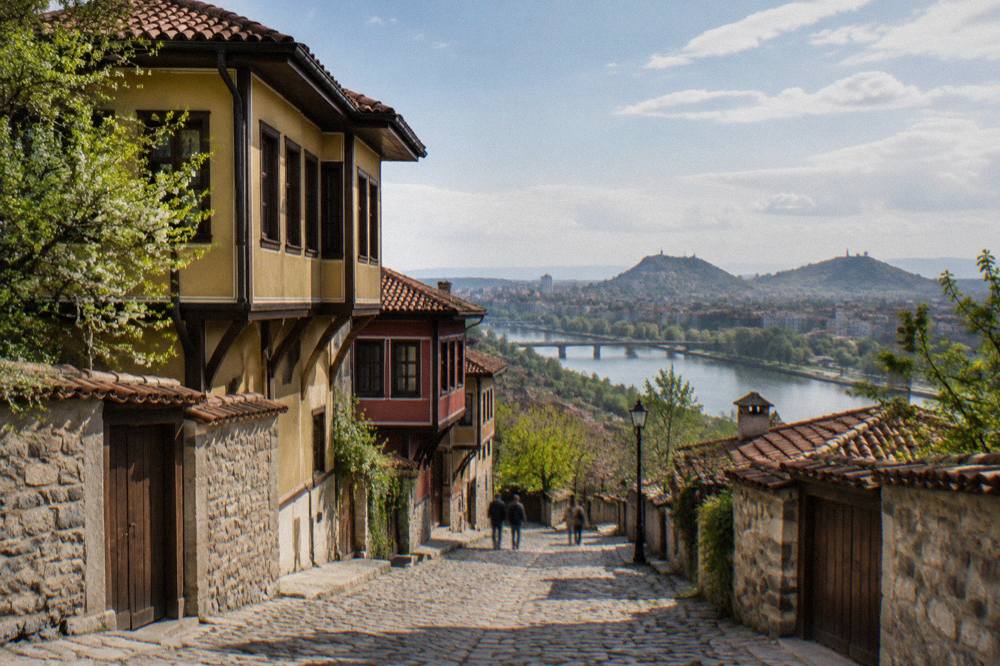
Plovdiv is built around six hills on the south bank and adjacent plain of the Maritsa river: the Three Hills group of Nebet Tepe, Dzhambaz Tepe and Taksim Tepe in the Old Town, plus Sahat Tepe, Bunardzhika and Dzhendem Tepe stretching west. There were seven until the 1930s, when Markovo Tepe was partly quarried away. The Three Hills carry the ancient core, Nebet Tepe being the settlement mound the city grew from, now a free open-air archaeological complex after its restoration opened in March 2025.
The hills are walkable public space, each with a distinct character. Sahat Tepe, Danov Hill, holds the clock tower and old cemetery. Bunardzhika, the Hill of the Liberators, carries the Alyosha monument, unveiled in 1957, a Soviet-era figure on a pedestal at 265 metres above sea level with open parkland around it. Dzhendem Tepe, Youth Hill, at 285.5 metres the highest of the six, closes the line to the west. The Three Hills guide and the Nebet Tepe guide cover each in turn.
The river is the second axis. The Maritsa flows west to east through the plain, and central Plovdiv spreads on its left, north-facing bank, with Karshiyaka district on the right bank and the Rowing Canal further along the water. Bridges link the two sides, and the flat ground between hill and river is where the modern centre, the Main Street and the Roman Stadium's excavated northern end all sit.
How Do You Get To Plovdiv From Outside Bulgaria?
Most international travellers reach Plovdiv either through Sofia Airport followed by a direct train of about 2 h 40 to 3 h 05 or a bus of about 1 h 45 to 2 h 20, or through Plovdiv Airport (PDV) at Krumovo, whose own flight search lists Belfast, Birmingham, Bratislava, London, Manchester, Milan and Tel Aviv. Bulgaria is a full Schengen member since 1 January 2025 and uses the euro since 1 January 2026, so travellers from the United States, United Kingdom, Canada and Australia enter visa-free for 90 days in any 180-day period.
Plovdiv Airport is small and seasonal. Ryanair's Milan Malpensa service and Wizz Air's Bratislava service are announced routes, running on set days of the week, and the London services operate across the year with seasonal variations; the direct flights from Plovdiv answer page tracks what the schedule means in practice. The airport sits at Krumovo, about 12 to 14 kilometres southeast of the centre, with a shuttle connection to the Yug bus station taking roughly 20 to 35 minutes per the airport transfer listings.
For anyone comparing the two airports, the arithmetic is simple. Sofia offers the frequencies and the rail link into the city; Plovdiv Airport offers a 20-minute ground transfer but a short route list. Entry formalities are identical at both: biometric registration under the EU Entry/Exit System, fully deployed since 10 April 2026, applies at the external border.
A quick comparison of the two arrival routes:
| Arrival route | Ground transfer to Plovdiv | Notes |
|---|---|---|
| Via Sofia Airport | Train from Sofia Central Station, about 2 h 40 to 3 h 05 | Main international gateway; several direct trains daily |
| Via Sofia Airport | Bus from Sofia Central Bus Station, about 1 h 45 to 2 h 20 | Arrives at Plovdiv Yug station |
| Via Plovdiv Airport (Krumovo) | Shuttle or taxi, about 12 to 14 km to the centre | Small route list: Belfast, Birmingham, Bratislava, London, Manchester, Milan, Tel Aviv |
Why Does Plovdiv's Location Shape What You Can See There?
Plovdiv's location on the plain between the Rhodopes and the Balkan Range puts a Roman theatre, a Roman stadium, revival-era houses and a creative district inside the city, and monasteries, fortresses, Thracian tombs and mountain gorges within a day's drive, so a stay can pair city sightseeing with a completely different landscape the same afternoon. The Old Town core sits on the Three Hills; Kapana, whose name means "The Trap", lies just below them; and the Rhodope foothills begin about 30 kilometres south.
Inside the city, everything clusters. The Ancient Theatre of Philippopolis, built in the 90s of the 1st century AD with 28 concentric rows of marble seats, stands on the Three Hills. The Roman Stadium's accessible northern part lies under the modern Main Street. The Bishop's Basilica with its over 2,000 square metres of floor mosaics sits by the Central Square. A walk between them covers a few hundred metres, which is why the one day itinerary works at all.
Outside the city, the radius widens fast. Bachkovo Monastery, free to enter as a working monastery, and Asen's Fortress lie south in the first foothills. The Thracian complex at Starosel and the town of Koprivshtitsa sit north in the Sredna Gora. Wonderful Bridges and the Trigrad gorge push deeper into the Rhodopes for a full day. For travellers who want a guide rather than a hire car, a day tour that bundles the monastery and fortress is the usual first choice; see the Bachkovo Monastery guide for the independent alternative.
One walk inside the city shows how location and history layer together: the Jewish heritage walk through central Plovdiv, which traces a quarter shaped by the same river-crossing trade routes that made the city's position valuable in every era. The tour's own page, the Jewish walking tour of Plovdiv, lists what it covers, and Check availability shows the operator's live listing.
Common Questions About Where Plovdiv Is Located
Where Is Plovdiv Located In Bulgaria?
Plovdiv is in southern Bulgaria, in the western Upper Thracian Plain, on both banks of the Maritsa river and around six hills. It is a direct train ride of about 2 h 40 to 3 h 05 southeast of Sofia, and roughly 100 kilometres from the Greek border crossings to the south, with the Rhodope Mountains beginning about 30 kilometres away near Asenovgrad.
Is Plovdiv On The Coast?
No. Plovdiv is an inland city with no sea coast. Bulgaria's coast is on the Black Sea, several hours east by road or rail, with Burgas and Varna as the coastal hubs. Plovdiv's setting is a river plain between mountain ranges, not a shoreline.
How Many Hills Does Plovdiv Have?
Six remain today: Nebet Tepe, Dzhambaz Tepe and Taksim Tepe as the Three Hills of the Old Town, plus Sahat Tepe, Bunardzhika and Dzhendem Tepe. There were seven until the 1930s, when Markovo Tepe was partly quarried away.
Which River Runs Through Plovdiv?
The Maritsa river. It flows west to east across the Upper Thracian Plain and passes through Plovdiv, with the central districts on one bank and Karshiyaka on the other. The Rowing Canal sits along the same water on the city's western side.
How Far Is Plovdiv From Sofia?
Direct trains take about 2 h 40 to 3 h 05 between the two city centres, and buses take about 1 h 45 to 2 h 20, per the operator timetables and listings the site summarises. Plovdiv Airport at Krumovo is about 12 to 14 kilometres from the city centre.
The short version: Plovdiv sits in the middle of southern Bulgaria's plain, ringed by hills it built itself on, with mountains to the south, the capital to the northwest and the sea nowhere in sight.